

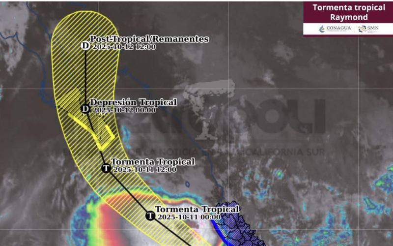
La Paz, Baja California Sur — Tropical Storm Raymond began moving toward the state of Baja California Sur this afternoon, according to forecasts from Mexico’s National Water Commission (CONAGUA).
We recommend you read: https://metropolimx.com/sinaloa-cartel-threatens-to-kill-u-s-citizens-living-in-los-cabos/
As of the latest advisory, the storm was located approximately 105 kilometers south-southwest of Playa Pérula, Jalisco, and 145 kilometers west-southwest of Manzanillo, Colima.
Raymond is packing maximum sustained winds of 95 kilometers per hour, with gusts reaching up to 110 kilometers per hour. The system is moving northwest at a speed of 24 kilometers per hour.
The effects of the storm are expected to begin early Saturday morning, bringing strong winds and rainfall to the region.
According to CONAGUA’s projections, the cyclone is forecast to make landfall around 6:00 p.m. Saturday between Cabo San Lucas and La Paz, specifically near the town of Todos Santos. It will then cross the peninsula and exit through the city of La Paz on Sunday, weakening into a tropical depression as it moves into the Gulf of California.
At this time, there is no official estimate of expected rainfall totals for Los Cabos and La Paz. However, forecasts indicate rainfall accumulations of 50 to 75 millimeters in Nayarit, and between 75 and 150 millimeters in the states of Jalisco, Michoacán, Colima, and Guerrero.
![]()